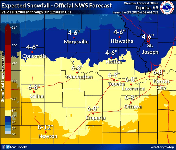
Image courtesy NWS
Meteorologist Matt Flanagan with the National Weather Service in Topeka briefed emergency managers and media again today, Friday January 23, on the upcoming winter weather. He said his confidence remains high that northeast Kansas will see accumulating snow and dangerous cold through the weekend and into Monday.
Flanagan said the first round of snow will intensify this evening, with the heaviest snowfall expected overnight and continuing into Saturday morning. A brief lull is expected late Saturday morning into the afternoon before a second round moves in Saturday night through Sunday morning.
Overall snowfall totals are expected to range from 2 to 5 inches across much of the area, with higher amounts farther south and southeast, especially near and south of Interstate 70. Some locations could see 4 to 6 inches, while totals of 8 inches or more are less likely and mainly possible near the I-35 corridor if both rounds hit the same areas.
Snowfall rates could reach up to half an inch per hour at times. Winds will remain breezy but are expected to gradually diminish, reducing the risk of blizzard conditions. However, light, powdery snow could still cause blowing snow and reduced visibility.
Flanagan also warned of very cold temperatures and wind chills below zero, continuing through Monday morning. Sunshine and slightly warmer temperatures are expected by Monday afternoon, with highs reaching the low to mid-20s.